Gorges and Caves

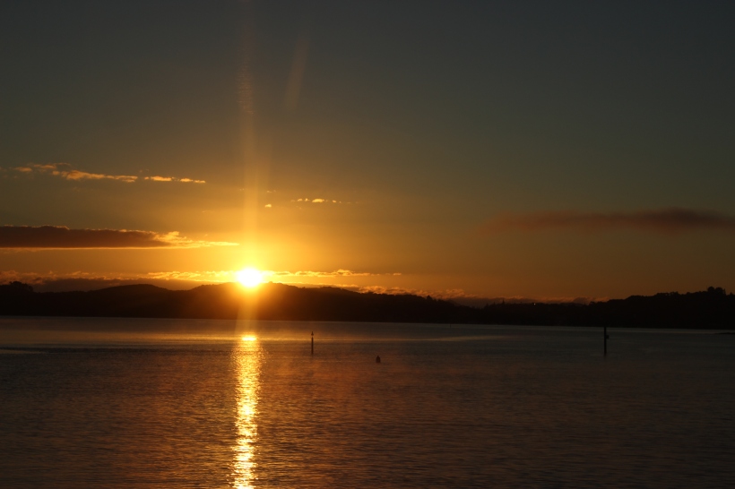
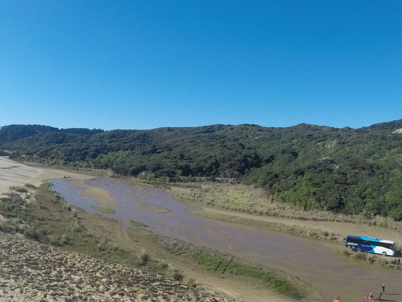
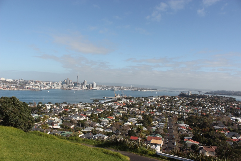
Today we had an early start, leaving Hot Water Beach at 7:30am to get on the road to Waitomo. We had a stop after driving for an hour or so at Karangahake Gorge. Featuring an old gold mine and historic railway remains, there are several walking routes around the gorge including the mine tunnels however after the recent deluge, the tunnels were flooded and inaccessible. Still, the sun finally put in an appearance (a little late if you ask me but but late than never) and it was lovely to stroll around the gorge. The area was very scenic with lots of dense native bush growing around the rushing water. There were a couple of bridges to cross which was exciting as they swayed as you walked over them. The bridges had a limit of 10 people and the higher towards that number you got the more the bridge swayed as you crossed.


After about half an hour exploring the gorge we piled back onto the bus. The second stop of the day was at Morrinsville to stop off at the supermarket to buy lunch and get supplies for our stay at the next accommodation.

We made good time getting to Waitomo, arriving at The Legendary Black Water Rafting Company just after 1pm. Here we paid for the activites we had signed up for yesterday. One of my friends was being very ambitious doing the Black Abyss adventure. I had considered doing this myself but I want to try and budget myself as sensibly as I can, especially as there are more exciting things on my list to do as yet.

Out of the activities available to us in Waitomo, I decided to go for the walking tour of Ruakuri Cave. Once we’d paid for our activities and the people doing the Black Abyss had got their gear from the bus, the rest of us hopped back onto the Kiwi bus to drive down the road to our accommodation for the night, Kiwi Paka. Not exactly a hostel, we were staying in a lodge which was split into rooms of varying bed numbers.

At 3pm we boarded the mini bus to go over to Ruakuri Cave. The journey didn’t take very long, and after about 5 minutes we were standing outside the cave, excited for the tour to begin.

The cave we would be walking through is called Ruakuri Cave. Rua means den in Maori and kuri means dog – so the name roughly translates to “den of dogs”. It was discovered by the Maori people about 500 years ago and it is the longest cave in New Zealand that has been discovered. The story goes that a young Maori boy was hunting for birds when he was attacked by wild dogs just outside of the cave entrance. The boy returned to the spot with others and they made the discovery of the cave network. We did not go to the original entrance as it was used by the Maori as a burial site which is now protected. The entrance we were standing by as our guide for the afternoon introduced himself, is much more recent – built 12 years ago when the caves were reopened.

The tour takes you down a spiral staircase where your eyes start to get adjusted to the dark with orange lights. Don’t fear, anyone interested in doing the tour who might be afraid of the dark. The rest of the tour is lit however the amount of light in the cave is strictly monitored in order to preserve such a unique environment.

We then walked around stalactites and stalagmites as well as other unique and unusual limestone formations dubbed cave coral. We also encountered a few fossils in the cave from prehistoric sea creatures which was pretty neat. There was the underground river as well and we heard our fellow Kiwi Bus teammates doing the black water rafting below us. The main attraction though, was the glowworms.

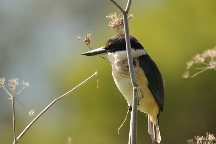
The glowworms which live in the caves are arachnocampa luminosa (which sounds like a Harry Potter spell) and they are unique to New Zealand. In certain areas of the caves, the walls and ceiling (if that’s the right word) are covered in glowworms. Of course, glowworms aren’t actually worms, they are the larvae of fungus gnats. As with many insects, majority of their life is spent in larvae form and they glow as a means to attract food. The glowworms are almost perfectly spaced from one another – if they get too close they can easily become a fellow glowworm’s dinner! They glow through bioluminescence – a natural phenomenon which occurs more commonly in marine vertebrates and invertebrates. In layman’s terms, bioluminescence is a chemical reaction which involves a light-emitting molecule and an enzyme. The light the glowworms produce is blue green and I tried to capture the sheer wonder of it with my camera but without my tripod the photos didn’t come out so good. Points for trying though.

The glowworms survive as larvae for between 6 to 12 months depending on food supply. When they hatch from an egg they are about 3 to 5 millimetres in size and can grow to about 3 centimetres – quite the growth spurt. At the end of the larva stage it comes a pupa and hang from the roof of the cave on a silken thread. It will continue to glow, albeit intermittently, for one or two weeks before emerging as a gnat. In this adult stage which only lasts a matter of days, the glowworms do not feed, they simply mate, lay eggs and then die.

This slideshow requires JavaScript.

It was a pretty sensational tour, with a very informative and entertaining tour guide to lead us through the caves. The sun was still shining when we made it back outside although by now it was much lower in the sky. We then had the short drive back to Kiwi Paka. Potentially pizza and a pub quiz beckons so my evening’s entertainment is sorted. I’m holding out hope that the weather stays fine for tomorrow for Hobbiton.


Narnia! (but not really)

So today marked the start of my journey around New Zealand back on the Kiwi Experience bus. I checked out of my hostel and headed over to Queen Street to join the other adventurers waiting for the bus. It was a relatively early start – we were making good headway out of Auckland by 9am. We stopped off for a quick toilet break, then headed over to Thames, a town at the southwestern end of the Coromandel. We stopped off for an hour for an early lunch and to buy food supplies for our stay at Hot Water Beach in the evening. I made a friend on the bus, a fellow Brit, and we spent our hour having a good chat about what we had both been up to in New Zealand so far.

Then it was back on the bus and we headed straight to Hot Water Beach. On the east coast of the Coromandel Peninsula, the beach gets its name from the underground hot springs which filter up through the sand between high and low tide. It is a an incredibly popular tourist spot in New Zealand with an estimated number of 700,000 annual visitors. With two hours either side of low tide, the done thing is to dig a hole in the beach and allow it to fill up with the hot rising water. Wait for the water to cool a little – no one wants a nasty burn – and voilà, you have your own hot tub in the beach itself.

The Kiwi bus was driving us to the Hot Water Beach Top 10 Holiday Park (a bit of a mouthful if you ask me) where we would spend the night. A clipboard listing the accommodation was passed around the bus, and I was said to see that, when the clipboard finally reached me, I had missed out on signing myself into the Tui Lodge. The Fantail Lodge would have to serve as substitute.

The Holiday Park itself is very nice, with an assortment of accommodation to cater for all needs. The lodge where I will be spending the night is perhaps the nicest backpacking accommodation I have stayed in so far in New Zealand. The room is very clean, the beds are comfortable and there aren’t too many jammed into one room. There is also a small kitchen area (the microwave doesn’t work but nevermind) and there is a bathroom area with two showers, two toilets and – you guessed it, two sinks. For the grand total of $32 I don’t think it’s too bad. Being the only accommodation at Hot Water Beach, I was initially dreading some awful place that was charging top dollar simply because it could. I was pleased to be proven wrong – and I supposed Top 10 is in the name of the place for a reason.

We arrived at the Holiday Park around 1:30pm and we had about half an hour to check in, sort out our day bags and meet roommates before most of us piled back onto the bus to go to Cathedral Cove.

When we left Auckland the sun was shining and it looked to be a beautiful day, regardless of where you might be in the country. I had checked the weather online, and it forecasted rain in the morning in the direction of our destination but it should clear up by the afternoon which would be perfect for our trip to not one but two beaches. When we arrived in Thames around 11am it was raining, but more drizzle than anything else. Once we hit the road again, the rain was steady but there was a glimpse every now and then of blue sky. Sadly, my optimism for the weather to improve was misplaced.

Cathedral Cove is beautiful, regardless of the weather, but I had hoped to enjoy it in the sunshine all the same. There is a path which takes roughly half an hour’s walk to reach the cove where you can wander across the two beaches, and of course through the cove. The weather was too bad for kayaking but on better days I can definitely see the appeal of exploring this section of New Zealand coastline from the water.

Accessible only via foot, boat or kayak, Cathedral Cove is a must see on the Coromandel. There are several scenic tracks around the Cove and the surround bays are popular for snorkelling and diving. You might recognise the cave and beach from the film Prince Caspian of The Chronicles of Narnia series when the Pevenise children make their return to the fantastical land. I can tick Narnia off my bucket list, just Middle Earth and Westeros to go.

After a brief wander around (the rain putting a damper on things) it was time to head back up the path to get the bus back to Hot Water Beach. With the low tide scheduled for around 5:45pm, the plan was to head to the beach, dig a hole and experience the magic. Of course, on the short drive back the heavens opened and any thoughts of heading to a beach of any sort was pushed far from my mind. Already being soaked from the walk back from Cathedral Cove, I decided the only other water I wanted to encounter was from a hot shower. After said shower and hanging my clothes up to hopefully dry, I had dinner and spent my evening writing my blog (of course).

The weather should not put you off doing things, I know, and as our driver, Dylan, said earlier in the day, New Zealand has a massive outdoor culture. Scenery, he rightly said, is free and the only way to enjoy it is to put yourself out there to see it. While I agree with this, it was a shame that the rain prevented today from being as sensational as it should have been. I have every intention of coming back to Cathedral Cove to enjoy it in all its glory, and I hope that the other weather dependent activities to do along the route of the still manage to go ahead. It looks like rain again tomorrow but should be alright on Wednesday. Fingers crossed everything stays fine for Hobbiton!

This slideshow requires JavaScript.

Up to the Top

Today I when on the day trip to Cape Reinga, the northwesternmost tip of the north island on New Zealand. It was another early start with the bus picking me up at 7:15am. After a quick loop of Paihia to collect our travellers for the day we were off as the sun started to rise.

IMG_9114

Our first destination of the day was the Puketi Kauri Forest. These trees are some of the most incredible trees you could hope to see, growing to over 50 meters tall and living for over 2000 years. Kauri forests once covered 1.2 million hectares of the north island before they were cut down, initially by the Maori people for boat building, carving and constructing houses. When the Europeans arrived, these trees were decimated due to the Europeans seeing them as ideal for ships masts and spars due to the fact the trees grew so straight. Today kauri trees are protected and about 2% of the initial population of the trees survive in New Zealand.

Kauri trees were also useful for the gum they produced. If a branch fell from one of the trees, a gum was produced naturally by the tree to protect the wound from disease until a new branch grew or the bark healed over. The gum would then fall to the forest floor and fossilise over millions of years to produce amber. Europeans would dig for the gum as it became an essential element in varnishes and other resin based products. A more drastic method of sourcing the gum would be to bleed the still living trees, which of course caused irreparable damage.

We stopped for about 10 minutes to have a walk around the kauri trees. These trees are still relatively young – about 400 years old. The kauri trees are easy to spot for the pale colour of their bark – as well as their size. These giants standing amid the New Zealand bush are quite spectacular.

This slideshow requires JavaScript.

In Waipoua Forest you can find the largest living kauri tree, Tane Mahuta – Lord of the Forest. According to Maori mythology, Raninui, the sky father, and Papatuanuku, the earth mother, were locked in a tight embrace and the world was darkest. Tane Mahuta, the strongest of their children, broke the two apart so that the sky and earth were separated. The tree is over 50 meters tall and has a girth of 13 meters.

We then headed up to Doubtless Bay for a quick stop. The sun was out by this point and while it was still a little chilly, it was turning into a beautiful day.  I had a little stroll along the beach and saw a gathering of oystercatchers which didn’t seem overly fussed by us tourists. They soon scuttled away as I got too close though. The beach here isn’t as shelly as Paihia but there was still plenty strewn across the sand.

IMG_9249

Then we were off to Houhora where we had an early lunch of fish and chips opposite Mount Camel. It was very picturesque, just us in the little bay – and the seagulls who were after our lunch. Captain Cook named Mount Camel in 1769, describing it as “a high mountain or hill standing upon a desert shore”. The fish and chips (or should that be fush and chups) were excellent – although I think the ones back home might be better – but only slightly. After lunch we hit the road again, this time it was a straight run up to Cape Reinga.

IMG_9345

Cape Reinga is also considered to be the point at which the Tasman Sea and the Pacific Ocean meet. It is a significant place to the Maori as it is here where the spirits of the Maori people depart the mainland on their journey to the afterlife. They travel to Three Kings Islands (of which we had a good view thanks to the clear weather) before looking back to the land, signing one final song to the loved ones they leave behind, and then continuing to their homeland of Hawaiki.

This slideshow requires JavaScript.

In 1941 the lighthouse was built, replacing the one which sat at nearby Motuopao Island as it was difficult to access. The lantern fittings from the Motuopao lighthouse were used at Cape Reinga however an electric lamp was fitted at the new lighthouse which could be seen for 26 nautical miles. In 1987 the lighthouse was fully automated and it is now monitored remotely from Wellington. The lens and lantern were replaced in 2000, powered by batteries which are recharged by solar panels. The beacon at Cape Reinga flashes every 12 seconds and has been viewed as far as 50km away. It is a stunningly beautiful place, and you feel very small standing at the edge of a country.

Fun fact – Cape Reinga is not the most northern point in New Zealand – the Surville Cliffs at North Cape which are 30km east of Cape Reinga are actually the most northern point. North Cape, however, is a scientific reserve and is not actually open to the public.

After our time at Cape Reinga, we drove to Te Paki Stream where we saw giant sand dunes which we could sand board down. To begin with, I was totally up for sand boarding – it looked pretty darn fun. Of course, looking down at the sheer drop of the sand dune once you’re up there is something of a different story. I took my time to big myself up for it, then absolutely failed when it actually came to flinging myself down this sand dune. But hey, at least I did it and I have the bruises to prove it.

GOPR0217.JPG

GOPR0218.JPG

Our driver was amazing – she was very funny and informative telling us about the history of the different towns and places we passed through as well as explaining the Maori heritage and language. The highlight would have to be when she put us all to shame, gliding down the sand dunes like a true professional.

After sand boarding, we headed back down to 90 Mile Beach. The beach isn’t actually 90 miles long – this comes from Europeans who were travelling the beach. Back in the day, the standard distance a horse was thought to cover in a day was 30 miles. It took explorers 3 days to travel from one end of the beach to the over, and so they believed the beach was 90 miles long and hence the name. The beach is actually 55 miles long, but 90 Mile Beach sounds way cooler.

IMG_9613

The beach is made cooler still by the fact it’s actually a highway and open for the public to drive on. Of course, you want to make sure you have the right vehicle for the job and stay on the right part of the beach. After a quick splash in the sea, during which I got soaked, we drove the bus along the beach.

Our final stop of the day was at Awanui where I bought the most amazing slice of banana cake to ever have existed and had a look around the souvenir shop which showcased furniture and sculptures made from kauri wood. After this pit stop we headed back to Paihia, the sun setting behind us as we went.

IMG_9717

Life Among the Clouds

Jetlag heralded another early start to the day, but you have to stay positive about these things. Although Ashling and I had made plans to head out for dinner I accidentally fell asleep and so dinner never happened. Still, everything worked out fine. Bright and early, I walked to her hotel then we headed out in search of breakfast. We went to a nearby supermarket and bought ourselves some goodies for breakfast and snacks to see us through the day. We also each bought a super healthy juice drink to make sure we didn’t go un-nourished. We walked to Albert Park and sat by the fountain to eat. We made friends with some very inquisitive sparrows before setting off to properly start the day.

IMG_2921.JPG

After a brief wander exploring new streets of the city, we decided on doing a tour of some kind. Luckily, we had both picked up a free Auckland A-Z guide from the airport and so we could easily have a flick through to see what tickled our fancy. We settled on the Devonport Explorer Tour and so we headed towards the ferry terminal to buy our tickets. For the grand total of $40 we got our return ferry trip and a bus tour which would take us to North Head and Mount Victoria. Due to our lucky timing we didn’t have long to wait for the ferry. We sat at the terminal then boarded. When we flew into Auckland it was dark so you couldn’t really get a scope of the city. Even walking round, it didn’t feel a particularly big city – like London for example. But when we were on the ferry looking over the skyline, you appreciate the size of the city.

IMG_2937.JPG

The ferry only took about 15 minutes and we walked down to where the tour bus was waiting for us. We met our guide Steve, a Devonport native who had great knowledge about the area and a fantastic sense of humour as well. There were only 3 on us on the tour, Ashling and I and an American tourist. We headed towards North Head and Steve began to tell us of the history of Devonport.

IMG_2953.JPG

Settled in 1840 by Europeans, Devonport was originally called Flagstaff for the fact there was a flagstaff raised on Mount Victoria which was used to communicate the incoming ships to Waitemata Harbour. The water of Waitemata Harbour is very deep which offered navy vessels suitable anchorage and so Flagstaff was established as a navy base. The suburb of Devonport was built for tradesmen and their families to live. There were separate ferries running to the navy base and Devonport, however due to financial difficulties, the ferry company operating out of Devonport was bought by the company which ran the ferries from the base. People boarding from Auckland would ask to go to Devonport, and over time the name stuck and the settlement in its entirety was renamed Devonport.

IMG_3058.JPG

On King Edward Parade the site of Devonport’s only public execution is marked. Joseph Burns was in the navy and by all accounts, not a particularly agreeable man. He left the navy and worked with a local boatbuilder. 3 murders were committed not long after Burns’ arrival – one victim was a navy officer. Burns, whose place of employment was a mere stone’s throw away from the scene of the crime, was found guilty and hanged for the crime.

Steve told us the houses on Devonport rarely sell as most of them are tied up in family trusts and handed down through the generations. With a population of 15,000, there is a real sense of community which clearly values its heritage. There is only one police officer on the island as crime is virtually non-existent. Devonport is 94% surrounded by water with a thin strip of land connecting it to the rest of the North Shore peninsula.

The houses are primarily all made of wood in Devonport. Due to there not being any white ants or termites, there is nothing to rot the wood. The only issue is UV – which Devonport gets a lot of. This means that the houses simply require repainting every 8 to 10 years in order to maintain the wood. Steve said there are trends in the colours used when it is time for the repainting. This time many of the houses are white, while previously blue was a popular colour, and before that a sort of beige, tea-colour. Many of the houses were built by shipwrights – when they weren’t building ships of course. Once the houses were built, the shipwrights were given the opportunity to live in them, cementing a culture of all things nautical in Devonport.

We walked around North Head at our leisure, taking in the spectacular views across the water to Auckland in one direction, the rest of Devonport in another, and out over the Hauraki Gulf. There were lots of sparrows about, and like the ones in Albert Park we had encountered that morning, they were very friendly. As we walked, we spotted swallows which was a nice reminder of home as the swallows had recently arrived there as well. What took us by surprise was the number of kingfishers sat perched in trees. Initially, I spotted a bird, unsure of what it was, and once I switched over to my big lens on my camera I could see exactly what it was. Given kingfishers are a favourite of mine, I was really over the moon.

IMG_3086.JPG

The New Zealand kingfisher is much bigger than its European cousin we all know and love. The plumage is quite different as well – a dark, inky blue back which turns a brilliant, bold blue when the light hits it right. Its chest is a pale cream and its beak is very dark. It has a small run of white around it’s neck – similar to the European kingfisher, but doesn’t have the speckles on its head and back. We saw at least 3 kingfishers at Mount Head, and a good half a dozen more as the tour took us around Devonport.

Mount Victoria is the highest volcano on Auckland’s North Shore at 87 metres tall. It was here where the flagstaff was based and the Signalman’s house where he would have lived with his family was built on one of the slopes. Today the house is used as a base by the Michael King Writers Centre which hosts numerous programmes, some of which are supported by Creative New Zealand and the University of Auckland. If I’d been braver and applied to do a semester abroad back at uni, who knows – maybe I would have had a writer’s retreat here.

IMG_3151.JPG

We had some time to kill before the ferry arrived to take us back to Auckland so we took Steve’s advice and headed to Devonport Chocolates. It was only a short walk away, down a road which was almost opposite the wharf. The smell of chocolate hit us as we walked inside and there was a vast selection of chocolate on display in and assortment of shapes and sizes – not to mention flavours. Ashling went for a shot of hot chocolate and I bought 2 chocolate dinosaurs – one milk chocolate and one white. I thought about taking a picture but I was hungry so ate them instead.

I noticed the occasional mural on the side of buildings around the streets of Devonport. While we were on the bus I saw one which was incredibly beautiful of flowers and a swallow and next door to Devonport Chocolate there was a mural of a bird. Luckily I was able to get a snap before we then needed to head back for the ferry.

IMG_3154.JPG

We headed to Ashling’s hotel to chill for an hour or two with the arrival of Ashling’s friend Charlotte imminent. Charlotte had been travelling around Australia and the South Island and was flying up that morning to meet up with Ashling so they could then travel around the North Island together.

We headed to the Skytower to get yet another view of the city. There are 2 viewing platforms – the main observatory level is 186 meters above street level with the Sky Deck at 220 meters. The view was amazing, even if the weather wasn’t as fantastic as it had been earlier in the day. It was amazing looking over the city and the Gulf beyond.

IMG_3191

We rounded off the evening with dinner at an amazing restaurant called Mexico. Ashling and I had passed it on our morning walk and it was pure happenstance that we walked by it again in the evening with Charlotte. Seeing as we were all hungry, and all love Mexican food, we thought it was a good choice. There was a great atmosphere inside; interior was fabulous – the red walls were adorned from top to bottom with an array of art and photos and there was a lit candle on every table. We sat down and ordered drinks – Sangrias for Ashling and Charlotte, and I went for a white cola seeing as the menu stated it was unmissable. I’d never had a white cola before and it was really good – infused with a ginger and cinnamon taste. It was weird, but a good weird. Charlotte had a taco and Ashling and I ordered quesadillas then we shared churros for dessert. Afterwards we said our goodbyes as the girls were moving on the next morning to Paihia with the Kiwi Experience bus while I was staying on in Auckland for another few days.